Image
Active Fire Behavior Continues Across the Black Fire with Red Flag Warning Issued
Community meeting scheduled for 7 p.m. Friday in Truth or Consequences
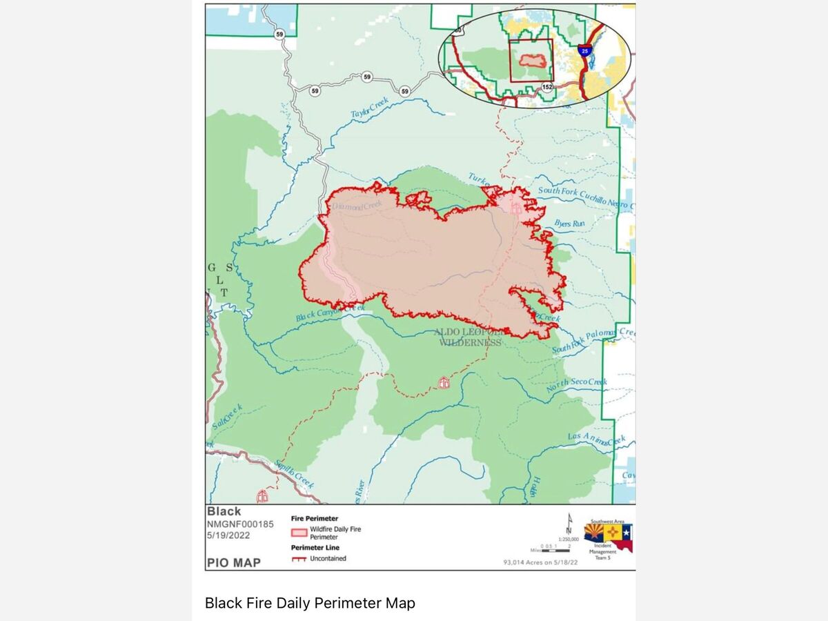
Daily Update 5/19/2022
Acres: 93,014 acres (Infrared flight Wednesday night)
Location: 31 miles NW of Truth or Consequences
Containment: 0%
Personnel: 450
Start Date: Friday, May 13, 2022
Cause: Unknown, under investigation
Fuels: Timber and tall grass
Announcement: A public meeting will be hosted on Friday at 7 p.m. at the Ralph Edward Civic Center, 400 West 4th St, Truth or Consequences, NM 87901.
Fire Update: On Wednesday, the Black Fire showed active fire behavior with upslope runs and crown fire in the tops of trees. Fire personnel were able to construct handline around the southwest side of the fire. They scouted potential fireline locations and constructed direct and indirect fireline, using hand ignitions to strengthen firelines where needed. Heavy equipment, including bulldozers, also assisted with building fireline within the Turkey Run area on the north side of the fire. Aerial resources assisted extensively, dropping water to assist firefighters on the ground and slow the fire’s rate of spread.
Today, firefighters will continue to work on Forest Road 150 (aka North Star Mesa Road or Wall Lake Road), located on the west side of the fire, from the Middle Mesa area to the south as well as from Diamond Creek north towards Beaverhead. Crews will assess structures threatened across the fire area, construct direct and indirect control lines and use point protection tactics. To date, no structures are known to be damaged or destroyed. Firefighters on the eastern side will scout and construct fireline when and where they can safely work and there is a good chance of success.
The Black Fire continues to burn in extremely dry timber and tall grass fuels. The fine fuels are very high across the fire due to last year’s robust monsoons and is a contributing factor to high rates of spread through previously burned and unburned areas. The fire is expected to spread rapidly where fuels and topography align.
Evacuations: Several areas have been evacuated or are in evacuation readiness. The sheriffs of Grant, Catron and Sierra counties are using the Ready, Set, Go program to notify residents of evacuation status. For detailed information on Ready, Set, Go! New Mexico, visit
https://www.emnrd.nm.gov/sfd/fire-prevention-programs/readyset-go-new-m….
In coordination with Grant, Catron and Sierra counties, the following areas are under evacuation status:
In Grant County:
GO: Starting from the Tom Moore Canyon Trailhead, nine miles to the west, south two miles, east to the Continental Divide Trail, and north two miles.
SET: Starting from the Tom Moore Canyon Trailhead, five miles to the west, three miles south, east to the Continental Divide Trail, and north three miles.
READY: Starting at the Tom Moore Trailhead, nine miles to the west, south five miles, east to the Continental Divide Trail, and north five miles.
In Catron and Sierra counties:
GO: Starting three miles south of Beaverhead, five miles to the west, south to the Catron and Sierra County line.
SET: From Beaverhead, three miles south to Kemp Mesa, four miles west, six miles east to the Catron County line, and three miles north.
READY: The area starting at the Grant County line south seven miles and east from the Continental Divide Trail approximately eight miles.
Sierra County:
GO: Residents in the Mud Spring Mountain area and the community of Hermosa.
SET: The area starting from one mile north of Lookout Mountain Trailhead, north seven miles, west to the Sierra County line and east to County Road 59. Starting from the Sierra County line north 12 miles, three miles east of the Continental Divide Trail, and west four miles.
Evacuation maps can be viewed at: https://inciweb.nwcg.gov/incident/8103/
Weather: A Red Flag Warning is in effect today and tomorrow. Relative humidity will drop below 10% with limited overnight humidity recovery. Temperatures will continue to be above average, and winds will range from 15-20 mph with 25-30 mph gusts.
Road Closures: Portions of Forest Road 150 (aka North Star Mesa Road or Wall Lake Road) is closed to the public. I-25 and other state highways remain open.
Smoke: The Black Fire produces heavy smoke that can be seen from all over the state. The smoke is drifting to the east affecting much of New Mexico before moving northward into Texas. Visit https://fire.airnow.gov/ for additional information.
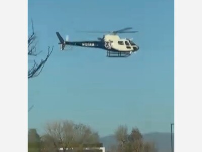
Aviation Restrictions: Airtankers and helicopters are available to assist for with fire suppression efforts. There is a Temporary Flight Restriction (TFR) over the Black Fire. Firefighting aircraft cannot fly if any aircraft, including drones, violates the restriction and poses a danger to firefighters on the ground by leaving them without aerial support.
Fire Restrictions: The Gila National Forest entered Stage 2 Fire Restrictions, effective at 8:00 a.m., Thursday, May 19, 2022. The New Mexico State Forester has implemented statewide fire restrictions. Information is available at https://www.emnrd.nm.gov/sfd/find-current-fire-restrictions/.
More Information:
Inciweb: https://inciweb.nwcg.gov/incident/8103/
New Mexico Fire information: https://nmfireinfo.com/
Facebook: https://www.facebook.com/GilaNForest
Twitter: https://twitter.com/gilanforest


Sunny, with a high of 90 and low of 48 degrees. Sunny in the morning, clear during the afternoon and evening,

Thank you for speaking up & demanding an investigation. Thanks for standing up for the people.

I notice Amy Barela's campaign sign today. "Your voice matter" So thought I would like Ms. Barela know, not stepping down as chairwoman you lost my vote. I want all my elected officials to be of high caliber, ethical be a cut above & stay on principles.
"Rules? We don't need no stinking rules!"
thank you for your insights - i have suspected that leaking mercury was at the basis for deciding to close the facility...and i imagine that the structural challenges of repair/replacement would be "astronomical".
still, it's sad to consider that it will be demolished.