Image
Mescalero Apache Sago Fire; Containment Reaches 17% -Alamogordo Town News

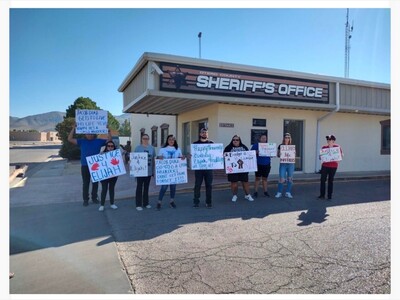
ALAMOGORDO, NM — March 30, 2026 — As the Sago Fire continues to burn on the Mescalero Apache Reservation, Tribal leadership and incident commanders released a joint update Monday evening, signaling a turn in the battle against the 282-acre blaze.
While the fire initially spread rapidly due to high winds and tinder-dry fuels last Thursday, the Gila Las Cruces Type 3 Incident Management Team reported that containment has officially reached 17%.
Statement from Tribal Leadership
In a community update, the Mescalero Apache Tribe expressed gratitude for the coordinated response and the safety of the crews on the front lines.
“We would like to express our deepest gratitude to the incredible teams working tirelessly. Their dedication is helping protect our lands and the Cow Camp facilities. We urge all residents and visitors to remain vigilant and cooperate with the current restrictions to ensure the safety of our community."
Leadership emphasized that while fire activity has transitioned to smoldering and creeping, the "Class III High Fire Danger" restrictions remain a critical priority for the reservation.
Incident Status Report
• Acreage: 282 acres (holding steady from Sunday).
• Containment: 17%.
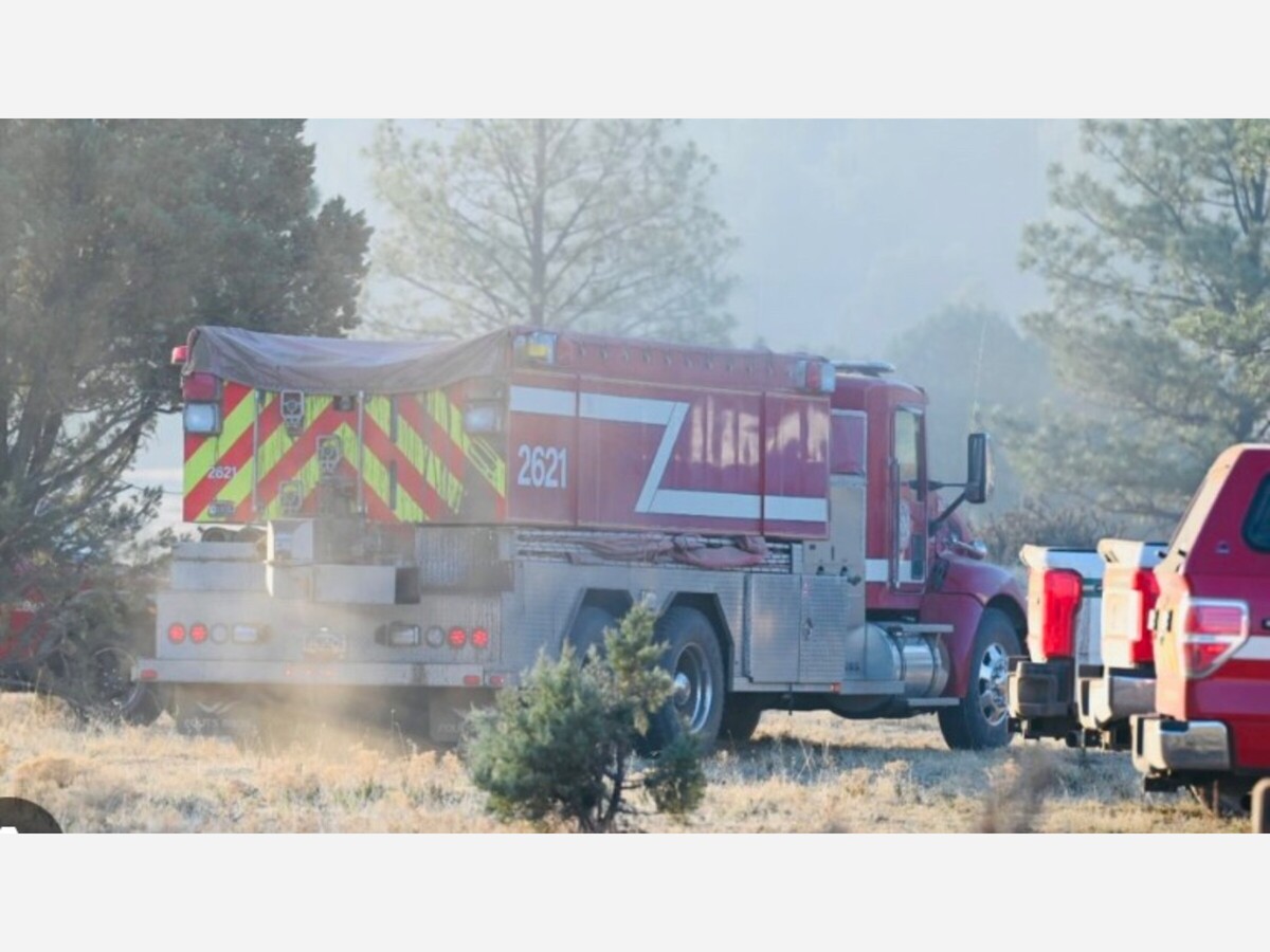
• Personnel: 105 firefighters, including the Smokey Bear Hotshot crew.
• Location: 19 miles east of Mescalero, near Sago Canyon.
Operations and Logistics
Firefighters spent Monday reinforcing handlines and dozer lines. With fire behavior moderating, crews have begun "mopping up" hotspots and assessing the area for suppression repairs.
A "spike camp" has been established near the fire to keep resources close to the line, with meals being provided by local restaurants to support the 105 personnel on-site. The incident command post remains at the BIA Mescalero Agency Apache Summit facility.
Public Safety Notices
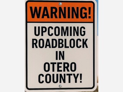
The Tribe and local authorities have issued several reminders for the Alamogordo and Otero County communities:
• Roads: While no official closures are in effect, the public is strongly advised to avoid Sago Canyon Road and Turkey Canyon Road.
• Drones: A Temporary Flight Restriction (TFR) is active. "If you fly, they can’t," officials warned, noting that unauthorized drones ground essential aerial firefighting tankers.
• Fire Restrictions: Under Class III High Fire Danger, campfires are strictly limited to designated areas at Silver Lake. The use of fireworks remains totally prohibited.
As temperatures are forecasted to reach the upper 70s with low humidity this week, officials are maintaining a full suppression strategy to ensure the fire does not escape established lines.

Thank you for your in-depth story on Freddie Duran. Freddie and I went to school together, and played in the awesome Tiger Band. He was also in choir, and always ready to entertain anyone who would listen. He was a great entertainer and just a great guy. He will be missed.

Sunny, with a high of 104 and low of 72 degrees. Sunny during the morning, clear overnight.

thank you for a clear review of the coverage of this grievous occurrence. i would make several observations:


So, it went from a semi open primary to a closed selection process limited to registered democrats being eligible for selection? Interesting.
i have participated in a much smaller scope version of this same situation - about 20 years ago, as a precinct chairman of the democratic party in a rural east texas county. after the primary election, the democratic candidate for a seat on the county commission suddenly died.
So any candidate regardless of party affiliation may submit their name for consideration?

here's hoping for expansion in the elephant graveyard...i can hardly wait until november 3rd.
It can join the corpses at the ******* cemetary.
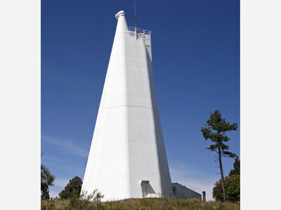
i visited the Sunspot observatory on my first trip through the Sacramentos, on a motorcycle ride in 1972, and have always included that site whenever introducing visitors to this many faceted region. it is sad to consider this unique scientific icon being demolished.