Image

Memorial Day 2024 will be a day many in New Mexico's firefighting community and the forestry community will remember as this weekend these agencies are involved in fighting 4 forest fires around the state.
The good news is the fire near Cloudcroft known as the Moser Fire is close to full containment. Per the most recent update on this fire 5 miles outside of Cloudcroft it is 92 percent contained and staffing has been reduced to Hotshot Crew, 1 Type 2 Crew, multi-agency engines, Volunteer Fire Department Crews. The Moser Fire has increased to 92% containment and remains at 96 acres.
Crews continue to monitor lines and look for hot spots and ensure the fire line is secure, moving directly within the perimeter to continue control measures.
The fire personnel will continue patrol and monitor confinement lines. Crews have continued to gain depth on mop up operations. Local and state resources will remain on scene throughout out Memorial Day weekend. There are pockets in the interior continuing to consume, which and may have a glow in the evening – this is normal during an incident.
Unless there are any major developments, this will be the final daily report on the Moser Fire.
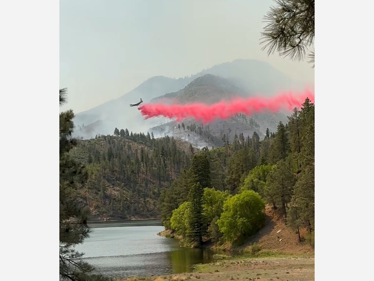
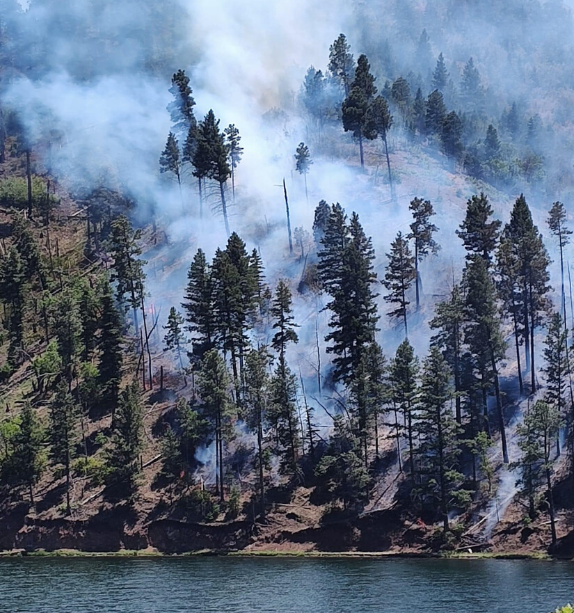
Next and nearby, 8 miles from Ruidoso and around Benito Lake in Lincoln County which is the primary water source for the city of Alamogordo that was due to reopen after 10 years, firefighters are fighting the Blue 2 Fire.
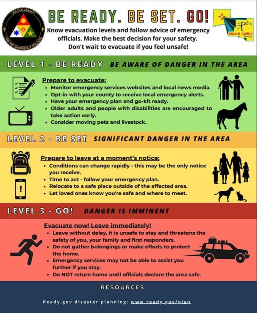
As a proactive precaution, Lincoln County Emergency Services has issued a new Emergency Evacuation for the Villa Madonna Subdivision. Go is also issued for area off Forest Service Road 127A, also known as Upper Eagle Creek, off of Ski Run road and surrounding area along 523 Ski Run road. Please evacuate to the Capitan Fairgrounds Shelter. For more information, please contact the Emergency Contact Center: (575) 336-8600.
LOCATIONS IN “SET” include: Sierra Vista & Sun Valley Subdivisions, All Ski Run Road, The Alto Area & The Community of Angus, Eagle Creek Sports Complex.
LOCATIONS IN “READY” include: Enchanted Loop Community and areas East and North of the community.
Please note this is a fluid situation and boundaries for ready, set, go are changing. Updated map of locations to come as soon as possible. Emergency Management Services are issuing non-opt in alerts to people in the “GO” area. You can hear more information on 1490 AM station.
Recreation, sporting events, and tourism occurring in the area should heed the warnings set by the county.
“As a precautionary measure, a command decision was made to engage early in safety evacuations. We will continue to be proactive while in command of this incident.” -Incident Commander, Lino Baca.
There is a new closure order issued by the Lincoln National Forest, Smokey Bear District. The restricted area is National Forest System lands, roads, and trails within and around the Smokey Bear District on the Lincoln National Forest. The western boundary of the Restricted Area is located at the junction of National Forest Service Road (NFSR) 400 and NFSR 108 Tanbark, NFSR 108 Tanbark to NFSR 107, NFSR 107 to Big Bonito trail #36 to the junction of Aspen Trail # 35, Aspen Trial #35 to the junction of Crest Trail #25, Crest Trail #25 to the junction of Trail # 78, Trail #78 to the Forest Boundary. The Southern boundary is the Forest Boundary from trail # 78 going east for approximately 4.75 miles, then due north for approximately 1/10 of a mile to road 532, road 532 east to the Forest Service Boundary. The eastern boundary is the Forest Service Boundary due north approximately 9 miles north to NFSR 400. The northern boundary is NFSR 400 west to the junction of NFSR 108 Tanbark Canyon, the junction of Rodamaker Trail # 20 along NFSR 107 to the Big Bonito trail #36. The purpose of this Order is to protect the safety of firefighter personnel and the public as firefighters engage in suppression tactics on the Blue 2 wildfire.
As of reports last night ago all evacuation orders still stand. Forest Service officials said that the Blue 2 Fire is now at 6,863 acres, still with no containment. There are 532 personnel working to get the fire under control, including personnel in the air who officials say were very active over the fire.
The Lincoln County Sheriff's office reported 30 minute ago that they, "just received word that a Fire Fighter from an outside jurisdiction who traveled here to help us with the Blue 2 Fire has suffered a medical emergency unrelated to the fire. This hero has been transported by ambulance to the hospital for treatment, status unknown."~Michael Wood, Lincoln County Sheriff.
More information may be found at https://www.ruidoso-nm.gov/news-info/awn4ka2wasj979r8nel3ldab4tf9m3?for…
In Northern New Mexico the Southwest Area Complex Incident Management Team 4 assumed command of the lightning caused Indios Fire at 7:00 AM this morning, Monday, May 27, 2024. A complex team brings additional resources and management capabilities to manage the Indios Fire. Incident objectives include protecting values at risk and meeting Santa Fe National Forest Plan objectives by reintroducing fire into a fire dependent ecosystem. Expected benefits include reduction of hazardous fuels, encouraging native growth, and improving range and watershed conditions, species diversity, and wildlife habitat.
The location of this 4th fire being battled in the forest areas of New Mexic is located 7 miles north of the village of Coyote, New Mexico. There is zero containment.
Despite windy conditions, 292 personal are on site and the fire has been predominantly driven by topography in steep, rugged terrain in the Chama River Canyon Wilderness. Firefighters continue to construct firelines by removing vegetation along existing roads and tying into natural features, such as rocky cliffs, around the fire area. Crews are strategically applying low intensity fire along Forest Road 77 to remove vegetation between a previous wildfire burned area and the main fire to prevent fire spread to the east. Firefighters have conducted aerial reconnaissance missions and observed beneficial fire effects across the landscape. Fire crews are working to minimize adverse fire impacts to federal and private lands including watersheds, natural and cultural resources, range, and agricultural infrastructure, and preserving landscape characteristics in the Chama River Canyon Wilderness. Additionally, firefighters are working strategically to minimize smoke impacts to communities and critical travel corridors to the extent possible.
A high pressure system will build over the area over the next few days resulting in increased temperatures and lower humidity. Mid-level clouds will develop over the mountains in the region bringing a slight potential for precipitation in the region by Tuesday or Wednesday.
Smoke from the Indios Fire became more visible in the surrounding communities yesterday, including Espanola and Abiquiu. Winds are expected to assist with smoke dispersal this afternoon. Smoke-sensitive individuals and people with respiratory problems or heart disease are encouraged to take precautionary measures. Learn more about smoke impacts on the New Mexico Environment Department website at https://www.env.nm.gov/air-quality/fire-smoke-links/. An interactive smoke map at https://fire.airnow.gov/ allows you to zoom into your area to see the latest smoke conditions.

