Image
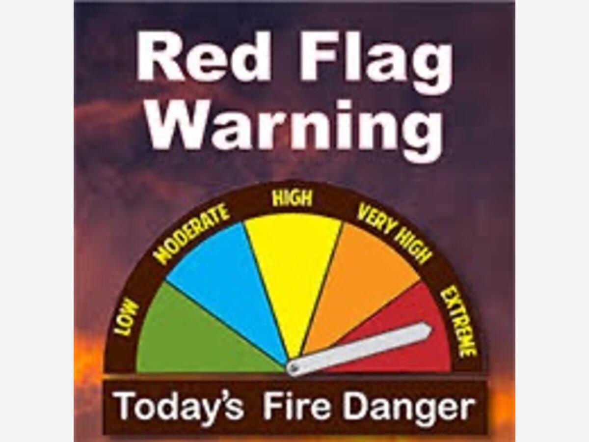

Red Flag Warning issued May 09 at 6:21AM MDT until May 10 at 9:00PM MDT by NWS El Paso
| ...RED FLAG WARNING IN EFFECT FOR WEDNESDAY AFTERNOON AND EVENING FOR SOUTHWEST AND SOUTH CENTRAL NEW MEXICO...
The region continues in an extended period of warm and dry conditions, as deep southwest flow delivers breezy afternoons. As such, fuels are continuing to dry. On Wednesday a Pacific low will eject across the Four Corners Region, tightening pressure gradients and inducing surface troughing. This will increase wind speeds across the area on Wednesday. A windy afternoon and evening will elevate fire weather conditions to critical. The probability for new wildfire starts and large growth of any existing fires will be increased. Winds will decrease for the end of the week, but RH`s will remain low. Relief is possible by Saturday as moisture looks to move in from the east to raise relative humditiy, and bring scattered rain showers. ...RED FLAG WARNING IN EFFECT FROM NOON TO 9 PM MDT WEDNESDAY FOR STRONG WINDS AND LOW RELATIVE HUMIDITY... The National Weather Service in El Paso Tx/Santa Teresa has issued a Red Flag Warning, which is in effect from noon to 9 PM MDT Wednesday. The Fire Weather Watch is no longer in effect. * AFFECTED AREA...In Southern New Mexico this includes fire weather zones 110, 111, 112, and 113. These zones include the Gila Region and Southwest mountains, the Southwest and South Central Deserts, and the Sacramento mountains and surrounding lowlands. * HUMIDITY...Minimum relative humidity of 5 to 9 percent over thelowlands and 8-14 percent over area mountains. Outdoor burning is not recommended. |
Learn more about red flag warnings on our podcast of AlamogordoTownNews.com radio edition on Krazy KALHRadio.org 95.1 FM
https://open.spotify.com/episode/5Wx7j2pDuRMDwWzc4eQ90W?si=zg1XXQ1AT0es…


Sunny, with a high of 79 and low of 49 degrees. Sunny in the morning, clear in the afternoon and evening,


yep, the doge's and the muskrats strike again - and the little people take another one on the chin.