
Image
Homes along Highway 70 in the Salt Fire burn scar are being evacuated because of heavy flooding in the area, a Mescalero Apache Fire Rescue social media posting said.
Village of Ruidoso spokesperson Kerry Gladden said that evacuees are welcome at the Red Cross Shelter at at White Mountain Relief Center at 687 Hull Rd. in Ruidoso.
Sunday evening saw ROAD CLOSURE INFORMATION
* Gavilan Canyon between Sutton and Meander
* Paradise Canyon
* Cree Meadows and Hull
* Cree Meadows and Wiley
* HWY 70 in both directions at Sudderth
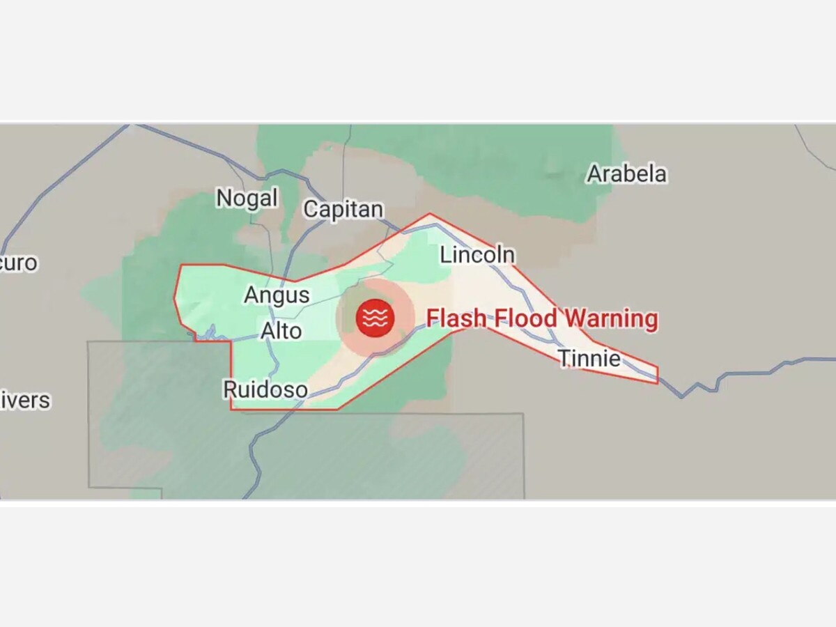
Per the National Weather Service at 321 PM MDT, Doppler radar indicated thunderstorms producing heavy rain over the Blue 2, South Fork and McBride Burn Scar. Between 1 and 2 inches of rain have fallen. Additional rainfall amounts of 1 to 2 inches are possible in the warned area. Flash flooding is ongoing or expected to begin shortly. This warning is in effect until 8 pm this evening.
Excessive rainfall over the burn scar will impact the Rio Bonito, Eagle Creek, Cedar Creek and Rio Ruidoso drainages as well as
downstream along the Rio Hondo. Impacts will include but are not limited to all nearby reservoirs, bridges, culverts and roadways
associated with these drainages, especially at those points where streams merge. Vulnerable properties in low lying areas are
especially at risk. Impacts could extend at least to Picacho, New Mexico. The debris flow can consist of rock, mud, vegetation and other loose materials.
FLASH FLOOD EMERGENCY for Ruidoso Area. This is a PARTICULARLY
DANGEROUS SITUATION. SEEK HIGHER GROUND NOW!
HAZARD.Life threatening flash flooding. Thunderstorms producing flash flooding in and around the Blue 2, South Fork and
McBride Burn Scar.
SOURCE...Radar indicated.
IMPACT...This is a PARTICULARLY DANGEROUS SITUATION. SEEK HIGHER
GROUND NOW! IMMEDIATE EVACUATION for areas in and around the Blue 2, South Fork and McBride Burn Scar.
Some locations that will experience flash flooding include...
Ruidoso, Lincoln, Ruidoso Downs, Fort Stanton, Glencoe, Alto, Lincoln State Monument, San Patricio, Bonito Lake and Hondo.
This includes Highway 380 between Mile Markers 91 and 107.


Sunny, with a high of 83 and low of 49 degrees. Sunny in the morning, clear during the afternoon and evening,