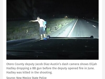
Image
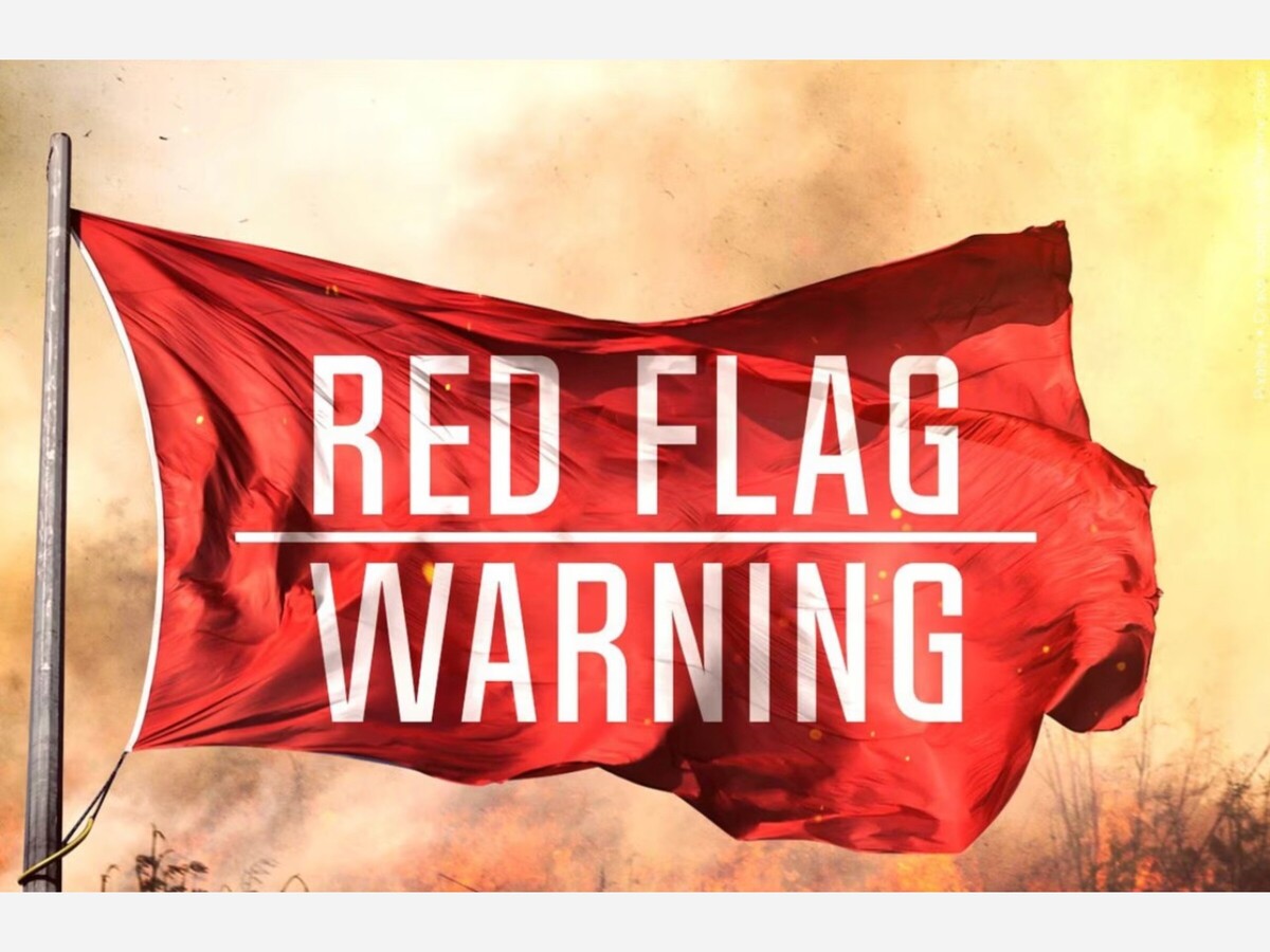

A Red Flag Warning has been issued for June 10 at 2:00 pm MDT until June 11 at 9:00 pm MDT by the National Weather Services El Paso Offices for the region to include Otero County, New Mexico.
Per the National Weather Service advisory…
”CRITICAL FIRE CONDITIONS EXPECTED SUNDAY FOR SOUTHWEST NEW MEXICO..
CRITICAL FIRE CONDITIONS EXPECTED MONDAY FOR SOUTHWEST AND SOUTH CENTRAL NEW MEXICO.
Expect winds to increase on Sunday ahead of an upper-level system, especially for areas west of the Rio Grande Valley.
The minimum RH values near 10% will combine with twenty-foot winds around 20 mph along with ERC values in the 85-90th percentile to create low-end red flag conditions.
Winds are expected to reach criteria around noon before diminishing after sunset.
Then, on Monday, breezy conditions will expand eastward to encompass all of south central and southwest New Mexico.
A RED FLAG WARNING IN EFFECT FROM NOON TO 9 PM MDT SUNDAY FOR WARM, DRY, AND BREEZY CONDITIONS FOR SOUTH CENTRAL NEW MEXICO.
A FIRE WEATHER WATCH IN EFFECT FROM MONDAY AFTERNOON THROUGH MONDAY EVENING FOR WARM, DRY, AND BREEZY CONDITIONS FOR SOUTH CENTRAL NEW MEXICO.
The National Weather Service in El Paso Tx/Santa Teresa has issued a Red Flag Warning, which is in effect from noon to 9 PM MDT Sunday.
A Fire Weather Watch has also been issued. This Fire Weather Watch is in effect from Monday afternoon through Monday evening.
AFFECTED AREA...Rio Grande and Tularosa Basin and Valleys of New Mexico.
WIND...
West to Southwest around 20 mph with gusts to 30 mph. * HUMIDITY...7 to 12 percent
HIGHEST THREAT...is located along and west of the Rio Grande Valley.
IMPACTS...
Any fires that develop will likely spread rapidly. Outdoor burning is not recommended.
What a Red Flag Warning means…
When the National Weather Service issues a Red Flag Warning it is notice to land management agencies of the imminent or actual occurrence of Red Flag conditions.
A Red Flag Warning will be issued when there is high confidence that Red Flag criteria will be met within the next 24 to 48 hours, or when those criteria are already being met or exceeded. A warning may be issued for all, or portions of a fire weather zone or region.
Criteria:
A combination of weather and fuels conditions (as determined by fire management) for any 3 hours or more in a 12 hour period. These criteria for the forecast area of the Denver/Boulder NWS office are defined as the following:
1. Frequent gusts of 25 mph or greater – AND relative humidity of 15% or less
2. Dry thunderstorms (15% coverage or more, constituting an LAL 6.)
OTHER FACTORS:
In addition to the basic criteria above, a combination of other elements may result in Red Flag Conditions:
3. Haines Index of 5 or 6, indicating a moderate or high potential for large, plume dominated fire growth.
4. Wind shifts associated with frontal passages.
5. First significant lightning event (wet or dry) after an extended hot and dry period.
6. Poor relative humidity recovery overnight (RH remains at 40% or lower.)
7. Any combination of weather and fuel moisture conditions which, in the judgment of the forecaster, would cause extensive wildfire occurrences.

Partly Cloudy , with a high of 78 and low of 44 degrees. Sunny in the morning, partly cloudy for the afternoon and evening, clear overnight.


Barela Block are both without the leadership conjones we need to move forward. Sissies lack testosterone right? She's not recuiting she coddles the gays.